The WRMP has launched the first Estuary-wide LiDAR data collection effort, capturing high-resolution elevation data across the San Francisco Bay and Delta to support wetland restoration, shoreline planning, and public access to geospatial data.
General Updates
South Bay Salt Pond Restoration Project Lunch and Learn on the WRMP
The South Bay Salt Pond Restoration Project held a Lunch & Learn presentation on the WRMP in June 2025. Click here to watch the recording on their website!
Summer 2025 Newsletter
The Summer 2025 newsletter shares new reports on tidal marsh extent and wetland condition, a tidal wetland restoration data layer, monitoring updates, information on wetland education and workforce development programming, and more!
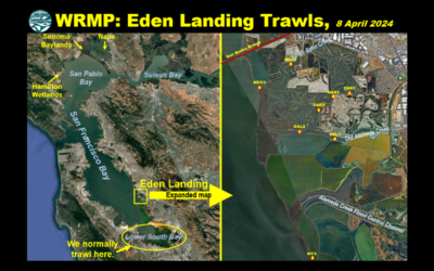
OG Fish Lab Blog Post: WRMP Eden Landing Trawls
Read a blog post from the Otolith Geochemistry & Fish Ecology Laboratory (OG Fish Lab) at UC Davis, highlighting the WRMP Eden Landing fish trawls.
Tidal Marsh Extent Webinar
The WRMP held a webinar on April 16, 2025 to discuss how we answered the question: How much tidal wetland do we have in San Francisco Bay? Watch the recording here.
Spring 2025 Newsletter
The Spring 2025 newsletter highlights a tidal marsh extent webinar, vegetation monitoring updates, alignment of indicators among programs, and more!
Esri Blog Highlights Baylands Habitat Map
Read a new Esri blog post highlighting the value of the Baylands Habitat Map: “Restoration Project Builds Climate Resilience in the San Francisco Bay.”
WRMP Featured in Maven’s Notebook
Read a Maven’s Notebook feature about the WRMP, “Quantum leap in collecting and unifying regional metrics on wetland health.”
WRMP Featured in KneeDeepTimes
Read a new KneeDeepTimes article about the WRMP: “Collecting and Unifying Regional Metrics on Wetland Health.”


