SOP Blog
Credit: Shira Bezalel
Are you curious about SOPs? What exactly are they?
For the purposes of the Wetland Regional Monitoring Program (WRMP), Standard Operating Procedures, also known as an SOP, detail the data collection and management procedures to monitor specific indicators. Indicators are based on quantitative and qualitative environmental conditions that are tracked over time. They can include measures of environmental or human health. A few examples of WRMP indicators include maps of bayland habitat types and tidal wetland elevations; spatial and temporal trends in the rate of sea level rise; and distribution and abundance of select non-native and invasive plant species.
Credit: Shira Bezalel
Why do SOPs matter to the WRMP?
-
- Producing reliable, consistent, and credible monitoring information to inform decision-making is at the heart of the Wetlands Regional Monitoring Program. WRMP indicators detect changes in wetland conditions over time. Scientists can more easily analyze data and compare wetland condition and restoration progress when different sites monitor the same indicators. This information is used to answer WRMP management questions about drivers of change for wetland restoration projects and monitoring sites
- To collect indicator data, scientists use various sources such as satellite-derived imagery, field measurements, or by utilizing existing datasets. Given the large scale of the WRMP, the San Francisco Estuary Partnership and the San Francisco Estuary Institute are partnering with other agencies to collect and analyze available data.
The Technical Advisory Committee (TAC) coordinates with technical experts across many disciplines including fisheries scientists, ecologists, spatial scientists, data scientists, and landscape ecologists. To guide monitoring efforts while ensuring consistent collection of salient information, the WRMP relies on the use of Standard Operating Procedures (SOPs).
“There are two types of SOPs used in the WRMP. One type of SOP is used for data collection, and ensures that monitoring methods and data collection procedures are standardized and consistent. The other type of SOP is for data management to guide how data is uploaded and shared on the WRMP Data Management Platform, which is currently under development.”
– Donna Ball, Senior Scientist for the San Francisco Estuary Institute and TAC Co-Chair
“The Wetlands Regional Monitoring Program is guided by scientific principles to reduce uncertainty in our understanding of the Bay’s environmental realities, and our data management system complements this core goal by advancing the most reliable, credible, and salient data.”
– Tony Hale, Environmental Informatics Program Director for the San Francisco Estuary Institute.
Credit: Carmen Zamora
Why are SOPs important/essential to the Program?
-
- The San Francisco Estuary restoration community is working rapidly to protect and restore wetlands that can provide flood protection, recreation, water quality improvement, and habitat for surrounding communities. In order to meet a regional target of 100,000 acres restored by 2030 (Baylands Ecosystem Habitat Goals Update), close coordination is needed between land managers, scientists and regulators. In order to reach this ambitious goal, the WRMP developed Management Questions that were of highest priority to our community of decision-makers.
-
SOPs play a crucial role by ensuring the underlying data collected to answer these questions are consistent and technically sound. Standardized data collection and monitoring ensures monitoring data can be shared and compared to other datasets. It is important to have accessible and consistent data for all because it can ease the understatement of the data collected in the Estuary. Ultimately, an SOP can streamline monitoring efforts and improve data comparability, allowing for high quality datasets that we need to construct adaptive management in the San Francisco Estuary.
Who uses SOPs?
-
-
SOPs are primarily used by people collecting and sharing monitoring data. This could include field staff, graduate students, regulatory staff, community-based research participants and researchers. While this pool of individuals tends to work with highly technical instructions for monitoring, many people benefit from the use of SOPs. This includes community-based organizations, Tribal members, managers, decision-makers, science educators.
-
In what ways is an SOP used for within the WRMP?
-
- Standardizes how people collect and share data
- Allows for WRMP data to be compared with data collected by others
- Provides quality assurance and credible data
- Standardizes how people collect and share data
What SOPs are currently being developed?
The WRMP is currently developing two SOPs.
-
- Geospatial SOP. The Geospatial SOPs was approved by the Technical Advisory Committee in April, 2022. It guides the development of the Baylands Change Basemap, a geospatial dataset currently under development that will help measure changes in habitat distribution and type across our region’s baylands. From there, the WRMP will identify locations of bayland habitat types (e.g., tidal marsh, tidal flats, diked bayland) and their key landform features (e.g., levees, channels, pannes, etc.), along with related information on location of their restoration projects. Closely related to this, are locations associated with estuarine-terrestrial transition zones and migration space. This SOP was developed by the Geospatial Working Group led by Pete Kauhanen (SFEI) and Christina Toms (SF Bay Regional Water Quality Board). You can find the summarized version of the SOP here.
-
- The Geospatial SOP was developed to answer Management Question #1 that states, “Where are the region’s tidal marsh ecosystems, including tidal marsh restoration projects, and what net changes in ecosystem area and condition are occurring?”.
-
- Geospatial SOP. The Geospatial SOPs was approved by the Technical Advisory Committee in April, 2022. It guides the development of the Baylands Change Basemap, a geospatial dataset currently under development that will help measure changes in habitat distribution and type across our region’s baylands. From there, the WRMP will identify locations of bayland habitat types (e.g., tidal marsh, tidal flats, diked bayland) and their key landform features (e.g., levees, channels, pannes, etc.), along with related information on location of their restoration projects. Closely related to this, are locations associated with estuarine-terrestrial transition zones and migration space. This SOP was developed by the Geospatial Working Group led by Pete Kauhanen (SFEI) and Christina Toms (SF Bay Regional Water Quality Board). You can find the summarized version of the SOP here.
- 2. Fish and Fish Habitat (FFH) SOP. The development of the Fish and Fish Habitat SOP includes a monitoring study review to identify past and ongoing fish monitoring that has been conducted in tidal wetlands in the lower San Francisco Estuary, and to identify gaps in fish monitoring that can inform the Wetlands Regional Monitoring Program and support future management objectives. The SOP is currently being developed by the Fish and Fish Habitat Working Group, led by Levi Lewis, UC Davis and Ali Weber-Stover, National Marine Fisheries Service.
-
-
- The Fish and Fish Habitat SOP was established to answer Management Questions #4A and #4B, that state, “How are habitats for assemblages of resident species of fish and wildlife in tidal marsh ecosystems changing over time?” and “How are the distribution and abundance of key nativeresident species of fish and wildlife of tidal marsh ecosystems changing over time?”
-
-
Credit: Cris Benton
Terminology
Management questions: Broadly framed questions and concerns regarding the planned management of natural resources.
Environmental monitoring: A set of methods that keep track of changes. Monitoring keeps track of all kinds of changes. harmful effects, changes in ecosystems and habitats, environmental processes etc. Some examples of environmental monitoring include looking at soil, air pollutants, and water quality.
Indicators: Indicators are based on quantitative and qualitative environmental conditions that are tracked over time for the health of the environment and human health and safety.
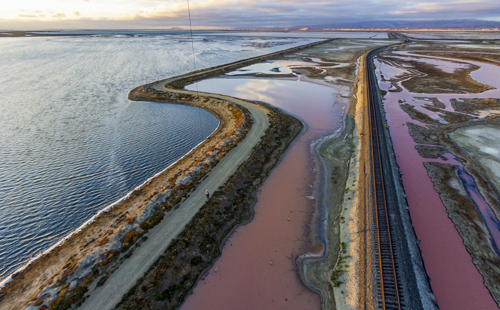
Bayland: The land that exists around the San Francisco Bay between the lines of high and low tide (land touched by the tides and lands that the tide would touch in the absence of unnatural structures like levees).
Geospatial: Information and data that is linked directly to a specific geographical location.
Editors
Carmen Zamora, SF Estuary Partnership
Heidi Nutters, SF Estuary Partnership
Alex Thomsen, SF Estuary Partnership
Tony Hale, SF Estuary Institute
Donna Ball, SF Estuary Institute

