
- This event has passed.
Webinar: Accessing WRMP Geospatial Results Through the WRMP Landscape Profile Tool in EcoAtlas
You’re invited to a Wetlands Regional Monitoring Program (WRMP) webinar: Accessing WRMP Geospatial Results Through the WRMP Landscape Profile Tool in EcoAtlas!
The WRMP has launched full scale data collection of tidal wetlands around San Francisco Bay to answer key management questions that will enable more successful wetland restoration and more cost-effective permit driven monitoring.
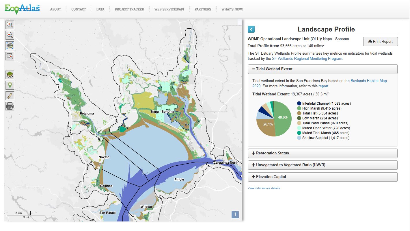
The SF Estuary Wetlands Profile tool in EcoAtlas presents a compilation of metrics about tidal wetlands based on the Baylands Habitat Map 2020, Project Tracker Tidal Wetland Restoration Map 2020 layer, and Tracking Tidal Wetland Extent in SF Bay, including tidal wetland extent, restoration status, unvegetated to vegetated ratio (UVVR), and elevation capital. The purpose of the Profile Tool is to support public policies and programs that protect aquatic resources and track regional progress towards meeting restoration targets.
This webinar will give a step-by-step tutorial on using the WRMP Profile Tool (http://sfei.li/wrmp-lp) to access and explore WRMP data. Both novice and experienced users of EcoAtlas are welcome!
When: Wednesday, January 14, noon – 1:00 pm
Where: Virtually, please register here: https://us06web.zoom.us/