WRMP
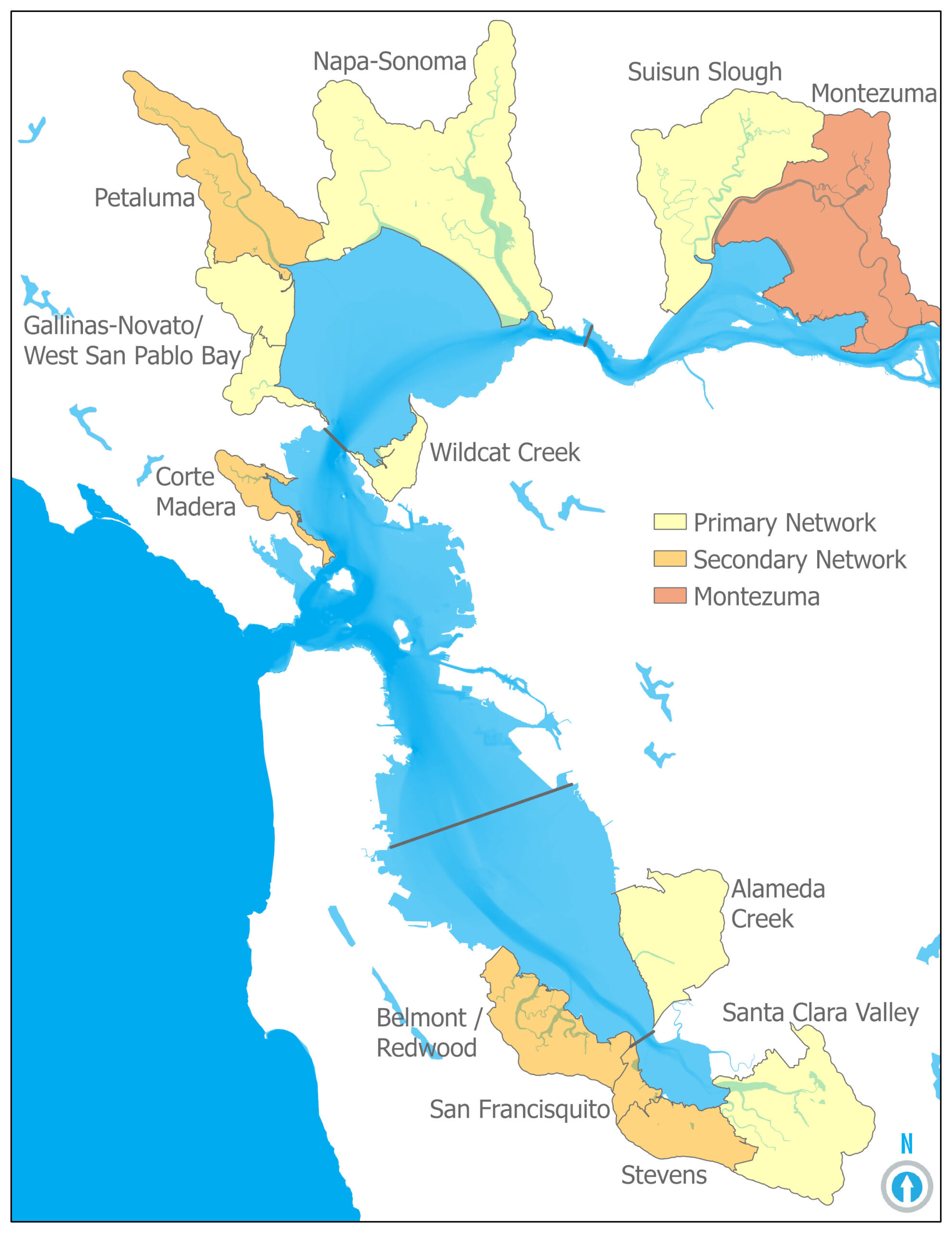
The WRMP Monitoring Site Network is the result of extensive research, coordination, and review by the WRMP core science staff, Technical Advisory Committee, and key Program partners and created to distribute representation across the lower Estuary. It leverages existing data sources and monitoring programs, contributes to shoreline adaptation planning, informs existing and planned tidal wetland restoration efforts, and addresses near-term WRMP science priorities.
The WRMP supports long-term data collection of key indicators that could trigger a management or regulatory action, prevent tidal wetland loss, or enhance tidal wetland conservation and recovery. WRMP data collection also is designed to identify these thresholds and to monitor changes in tidal wetland distribution, abundance, and condition over time. To do so, the WRMP created a Monitoring Site Network, which delineates three monitoring zones (Primary, Secondary, and Montezuma), each containing three types of tidal wetland monitoring sites: Benchmark, Reference, and Project sites.
Benchmark sites are historic, minimally modified mature tidal wetlands that represent pre-colonial ecosystems. Reference sites comprise century-old fringing wetlands, well-established restoration projects, and other mature marshes that represent reasonable habitat development endpoint projections for newer restoration projects. Project sites are recently restored tidal wetlands that represent a variety of design and management approaches.

