Monitoring Results
Wetlands & Sea Level Rise
Wetland surface elevations, sediment deposition patterns, and sea levels
Tidal wetlands exist along the land-water interface and are strongly influenced by sea levels, sediment, elevation, and tides. The WRMP uses several standardized approaches to monitor how tidal wetlands are keeping pace with rising seas across existing and restoring sites around the Bay.
Tidal wetland elevations keep pace with sea level through sediment deposition and slow plant decomposition. Understanding how marsh elevations change in relation to sea levels requires a multi-pronged approach. This is particularly important in restoring sites, which might be at lower tidal elevations. The WRMP is measuring ground surface elevations using both field based and remotely sensed techniques. Daily tide levels, as part of annual and decadal sea level tracking, and sediment in the water are measured using sensors that record levels several times an hour. Wetland surface accretion and subsidence is tracked through surface elevation tables and sediment deposition is measured using marker horizons.
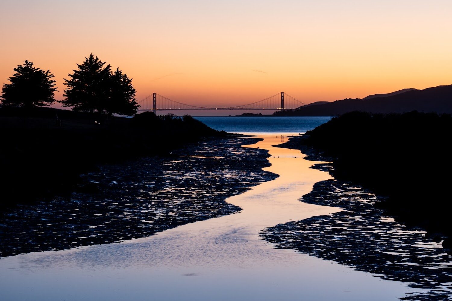
Sunset from Pt. Isabel. Photo by Shira Bezalel.
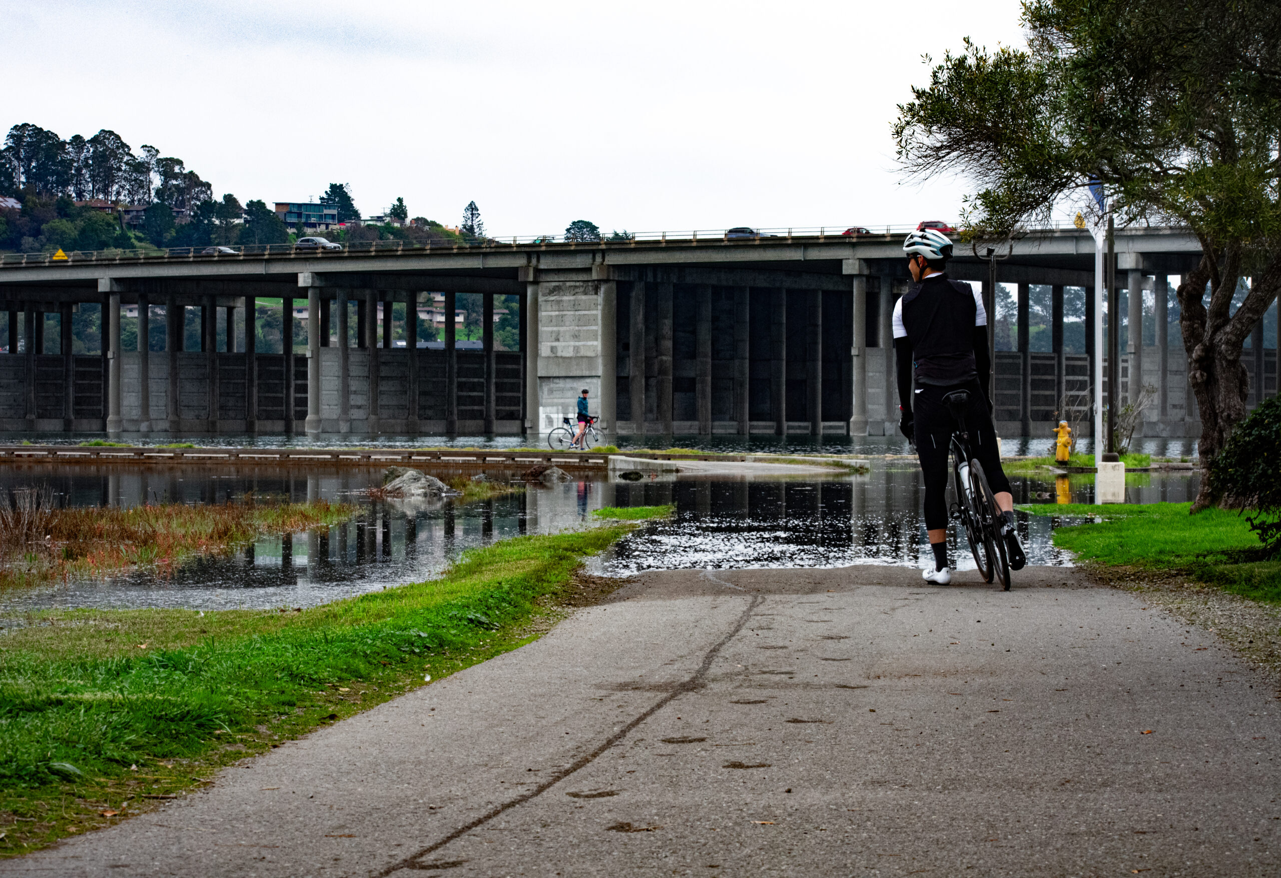
Flooded pathway in Marin County. SFEI
Wetlands & Sea Level Rise
Challenge & Response
Sea level rise is already altering many habitats, including low-lying coastal areas like the SF Estuary. Tidal wetland drowning is one major risk from these changes. Wetland drowning is when the water levels become high enough for a longer duration to the point the wetland can no longer support vegetation, and it becomes a tidal panne, tidal mudflat or even open water. The ability of the marsh to increase ground elevations depends on the accumulation of sediment. Some marsh drowning is inevitable as the sea levels rise, and the upland areas adjacent to marshes play an increasingly important role in allowing the landward migration of tidal marshes.
The Baylands Habitat Map and sediment accumulation monitoring allows the WRMP to generate region-wide data to identify areas of management concern and the potential to maintain tidal wetlands with respect to sea level rise.
Science Framework
Monitoring wetland elevation and accretion is an important component of the WRMP Science Framework, helping to understand if wetlands are drowning due to rising seas.
- How are tidal marshes and tidal flats, including restoration projects, changing in elevation and extent relative to local tidal datums?, What are the regional differences in the sources and amounts of sediment available to support accretion in tidal marsh ecosystems?, What new information do we need to better understand regional lessons from tidal marsh restoration projects, advance tidal marsh science, and ensure the continued success of restoration projects?, Where and when can interventions, such as placement of dredged sediment, reconnection of restoration projects to watersheds, and construction of living shorelines, help to sustain or increase the quantity and quality of tidal marsh ecosystems?
Wetlands & Sea Level Rise
Key Metrics & Figures
The WRMP has developed metrics to track how tidal wetlands and restoration projects are faring in the face of sea level rise and changes in sediment availability. These include rates of sediment deposition and elevation change (accretion and subsidence), as well as shifts in wetland plant communities along wetland edges.
Looking for local data and information?
Metrics describe how the WRMP conducts science to better understand and monitor the Estuary’s tidal wetlands, like water quality, fish habitat, wetland condition, and benefits to humans. Explore all the WRMP’s metrics, which aim to guide wetland management and restoration.
Wetlands & Sea Level Rise
How We Monitor
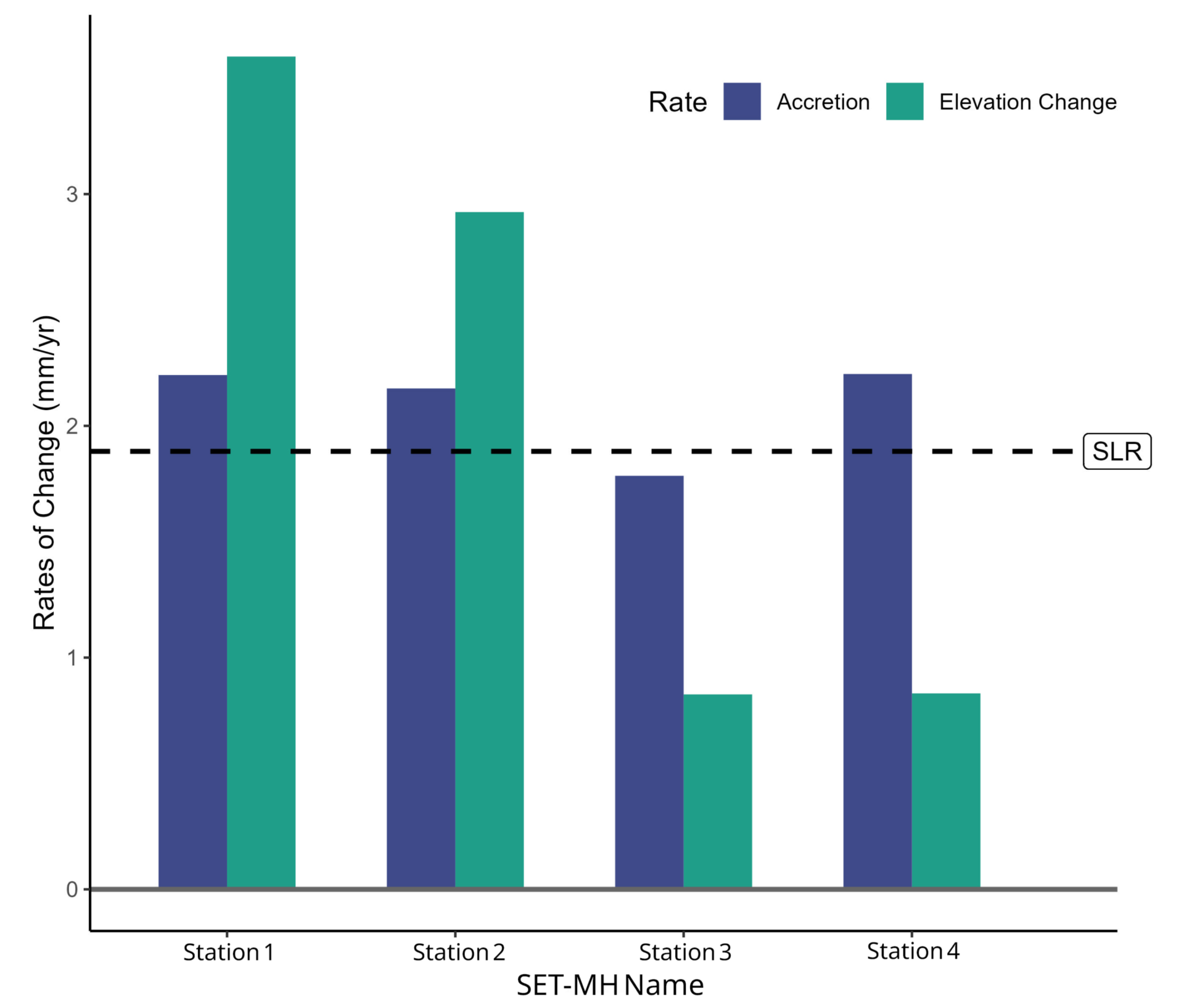
To understand if wetlands are building elevations relative to local sea levels, the WRMP is using a standardized approach of installing Surface Elevation Table – Marker Horizon (SET-MH) networks.
Surface elevation tables (SETs) and marker horizons (MHs)
1
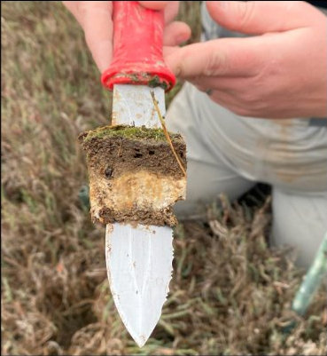
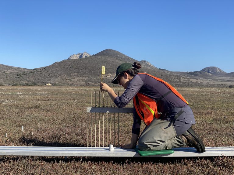
Sediment deposited on the clay marker horizon. USGS
Goals and objectives
- How does wetland sediment deposition and elevation change over time?
- Does this vary around the Estuary or within a marsh?
- Are wetlands keeping pace with sea level rise?
2
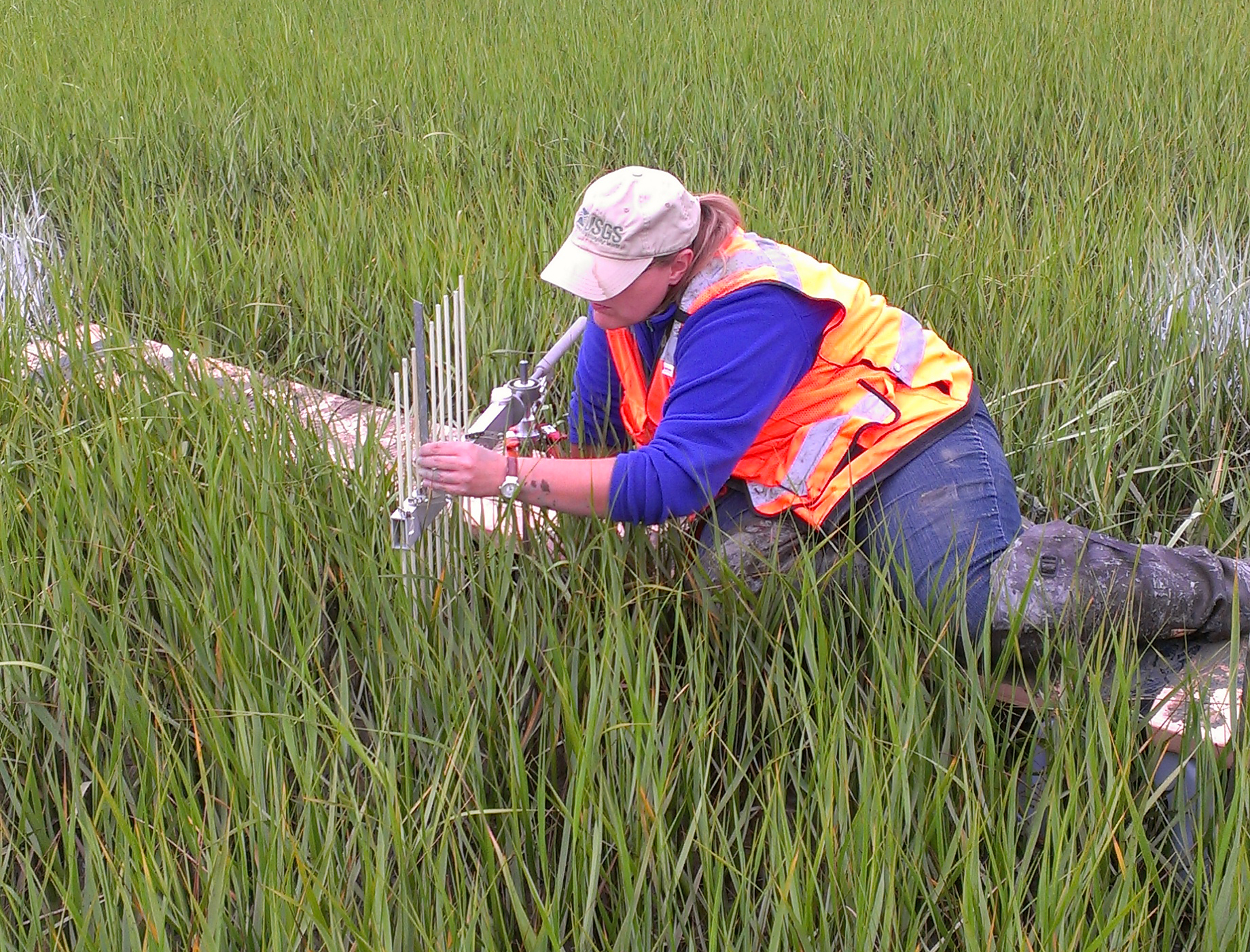
Scientist measuring SET elevations. USGS
What data we collect
- Elevation change: the total soil development measured by the SET pins.
- Accretion: the vertical marsh soil development above the marker horizon clay layer.
- Shallow subsidence (compaction / expansion): the subsurface soil change that is calculated as the difference between elevation change and accretion.
3

WRMP
Where we collect it
- Tidal wetlands across the Estuary, including historic and restoring sites.
- Four locations within each tidal wetland, two sites near channel edges and two away from channel edges.
4
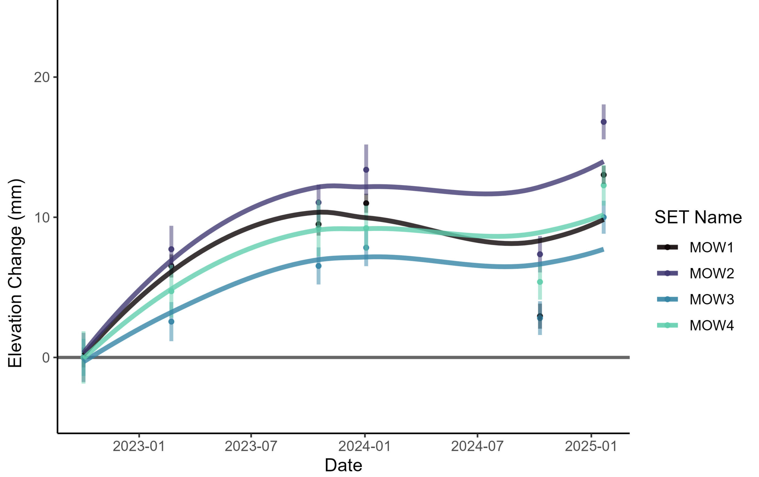
Elevation change over time at Mowry marsh. USGS
What insights we expect
- How much sediment is being deposited on the marsh surface.
- Whether tidal wetlands are gaining elevation at rates comparable to sea level rise.
- Understanding differences in elevation change between historic and restored tidal wetlands.
Wetlands & Sea Level Rise
Measuring Surface Elevation Change
case study
The WRMP uses long-term monitoring to understand if marshes are building elevations relative to local sea levels using deep rod Surface Elevation Table – Marker Horizon (SET-MH) networks. Individual SET-MHs sites measure total elevation change and accretion (elevation increasing over time from soil deposition and root expansion). This type of monitoring allows for comparisons across wetlands to a better understanding of the relationship of wetland elevation changes to the conditions in the Estuary. It also helps to understand how these systems are responding to sea level rise. Once the SET-MH network is installed, it needs to be regularly and consistently measured to collect information about how the surface elevation and accretion has changed.
The WRMP is partnering with Dr. Karen Thorne at the US Geological Survey (USGS) to conduct the SET-MH monitoring within WRMP sites. The USGS had already installed SET-MHs at multiple sites in the Estuary starting in 2011. The WRMP is supporting monitoring of these sites bi-annually and also supporting the installation and monitoring of additional SET-MHs in the Estuary.
Surface elevation table reading. Photo by USGS.
China Camp tidal wetland and uplands. SF Bay NERR.
Wetlands & Sea Level Rise
Transition Zones
case study
Small changes in inundation and salinity can have dramatic effects on tidal wetland plant distribution. This often happens along wetland edges (or transition zones). These transition zones are areas where one habitat blends with another, specifically where mudflats transition to tidal wetlands and tidal wetlands transition to uplands. Transition zones often have the most species within tidal wetland ecosystems.
Establishing short monitoring transects across these zones dramatically increases the efficiency of assessing plant communities, and measuring these over time can be effective at documenting shifts in plant distribution. As sea levels rise, tidal wetlands can slowly move upland to areas that previously were not tidal and tidal wetlands can shift to mudflats as water levels become too deep for vegetation to survive. By documenting early plant responses, the management community can initiate proactive steps to protect restoration projects and evaluate the progress of management actions in a regional context.