Tidal Wetland Extent
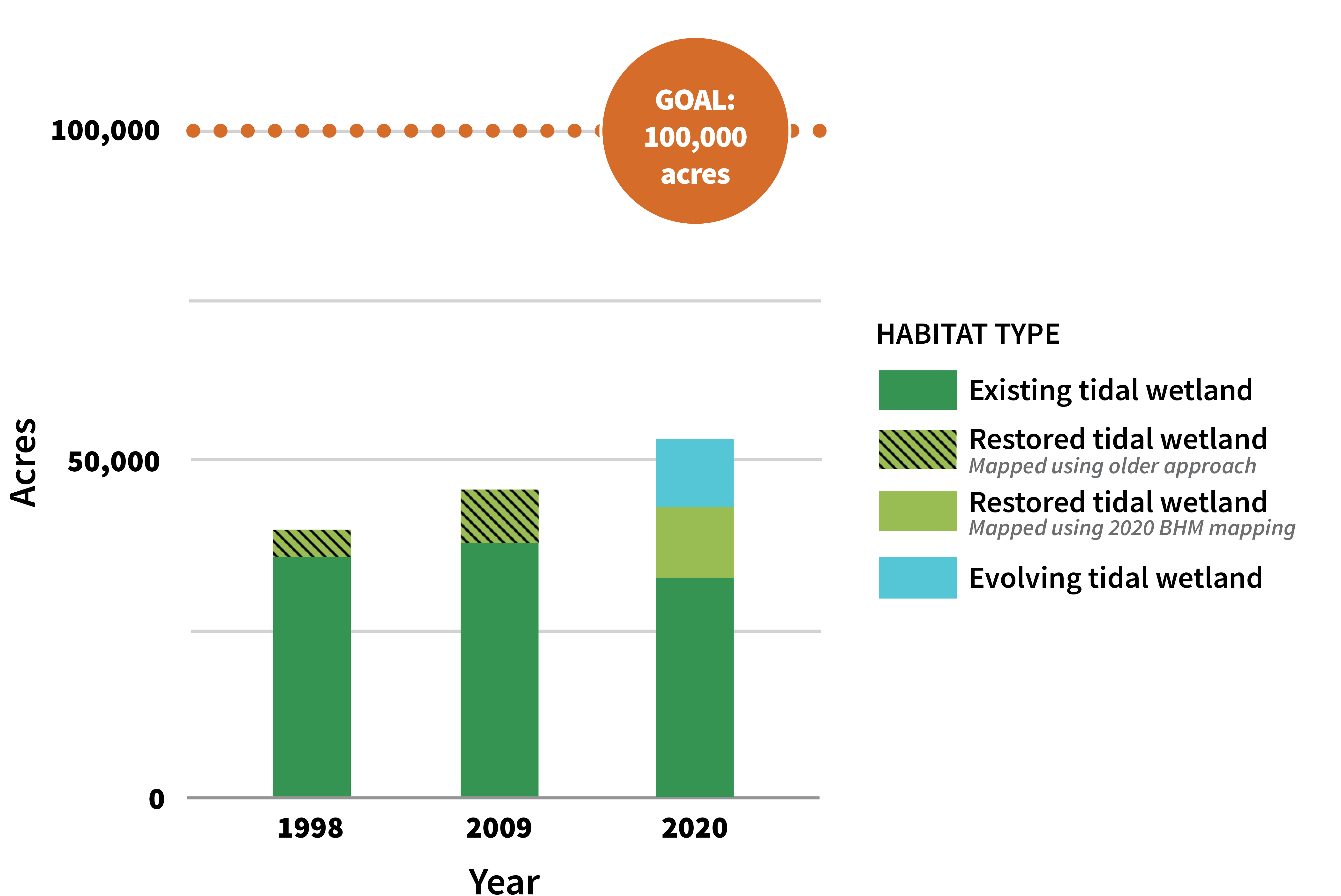
Repeated, consistent mapping over time provides critical information about tracking changes in tidal wetland acreage, distribution, and condition over time towards the goal of having 100,000 acres of healthy wetlands in the Estuary. To calculate the 2020 extent, the WRMP created a new protocol that combined the Baylands Habitat Map 2020 with refined EcoAtlas Project Tracker restoration information to measure tidal wetland extent and restoration evolution. This has not occurred since 2009. The protocol provides more detailed characterization of restored wetlands to monitor their evolution over time, introducing a new category for restoration sites that have not yet become vegetated. Tidal wetland area has steadily increased over time due to the restoration community’s concerted efforts, and the protocol developed by WRMP provides a consistent method to continue to track changes into the future. As of 2020, there are 53,700 acres of tidal wetlands in the Estuary.
Downloads:
PNG
Science Framework
The creation of this metric is guided by our Science Framework Management Question(s):
- What is the distribution, abundance, and condition of tidal marsh ecosystems, and how are they changing over time?
- How are the benefits of wetlands (such as flood risk reduction, water quality, public access, opportunities for community stewardship, knowledge production & transmission, and cultural & spiritual experiences) distributed regionally?
Looking for local data and information?
See WRMP data by visiting the WRMP EcoAtlas Profile Tool.