Accurate tracking of wetland restoration progress
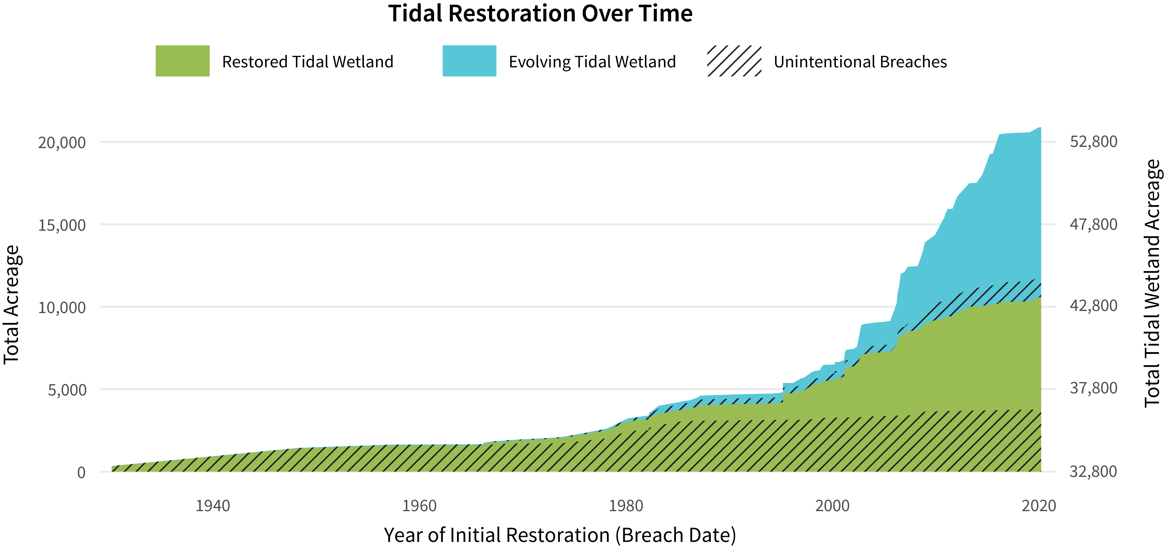
EcoAtlas Project Tracker, a statewide online tool to track wetland restoration projects, is the most complete database of restoration projects and valuable for planners and land managers. However, known issues with data have limited Project Tracker’s ability to comprehensively track wetland restoration acreage in the San Francisco Estuary. In response, the WRMP created the Project Tracker Tidal Wetland Restoration Map (PTTWRM) layers for the Estuary that address the previous limitations for the current state of tidal wetland restoration from Project Tracker. Annual updates, starting with PTTWRM 2020 and 2024, include verified dates of all restoration sites and how they were restored to tidal flow. Most tidal restoration before 1980 resulted from unintentional levee failures. Restoration efforts into the future can now be accurately tracked against the goal of having 100,000 acres of healthy tidal wetlands. Over 20,000 acres have been restored as of 2020.
Downloads:
PNG
Science Framework
The creation of this metric is guided by our Science Framework Management Question(s):
- What is the distribution, abundance, and condition of tidal marsh ecosystems, and how are they changing over time?
- What new information do we need to better understand regional lessons from tidal marsh restoration projects, advance tidal marsh science, and ensure the continued success of restoration projects?
- How are habitats for assemblages of resident species of fish and wildlife in tidal marsh ecosystems changing over time?
Looking for local data and information?
Learn more about how PTTWRM layers were developed in the Tidal Wetland Extent Report.